There is a place in Manisa that will take you from Turkey and take you far away to Iceland. Kula Divlit Volcanic Park, which I find hard to believe is in Turkey, is Turkey's first and only UNESCO-labeled Geopark. Kula – Salihli UNESCO Global Geopark is located in. Within the scope of the geopark, there are Kula Fairy Chimneys, Çakırca Basalt Columns and Sandal Divlit Volcano, as well as Kula Divlit Volcanic Park. In this article, the details of Kula Divlit Volcanic Park located within the borders of Manisa province and geopark I tried to explain such concepts as my tongue turned, enjoyable reading!
What You Will Find In This Article
Where is Kula Divlit Volcanic Park ?
Kula Divlit Volcanic Park, Kula – Salihli Geopark area, 17 kilometers from Kula, 132 kilometers from the center of Manisa, and 80 kilometers from the center of Uşak.
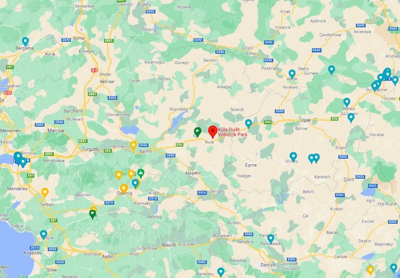
Google Maps application of Kula Divlit Volcanic Park. Click for location.
Unfortunately, there is no public transport access to Kula Divlit Volcanic Park, you can go with your own vehicle or with a tour. If you are not traveling with your own vehicle or tour, you can try to reach Kula district of Manisa by taxi or hitchhiking.
Your Questions About Kula Divlit Volcanic Park
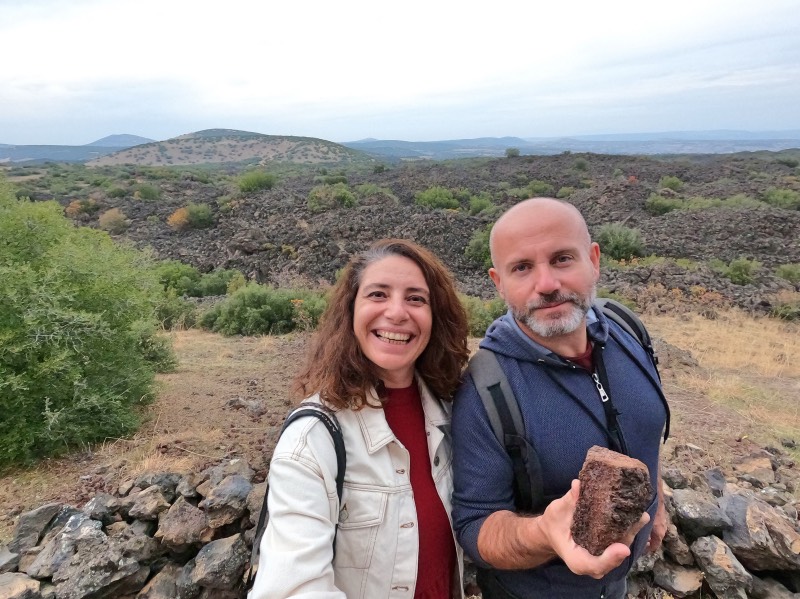
Kula Divlit Volcanic Park is one of the youngest volcanic areas in Turkey. It has all the landforms that I expect to be formed as a result of volcanic activities. The Kula Divlit Slag Cone, located in the park area, is the most important volcanic area of our country in terms of natural, geological, cultural and archeological aspects with its lava flow, parasitic cones, spatter cones, lava tunnels and ditches, and its geological heritage with a history of more than 200 million years.
Kula-Salihli Geopark became the first Turkish Geopark to pass the UNESCO Geoparks Network inspection in 2013 and thus, it has the title of the first and only UNESCO-tagged geopark of our country.
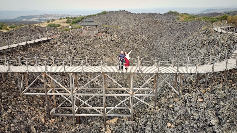
In the volcanic park, there is a walking path with a one-way length of about 3 km, which allows you to see the geosites closely, three wooden bridges that allow you to see the lava remains from above, and a bicycle track with a length of approximately 35 kilometers.
When you enter the Kula Divlit Volcanic Park area, a security booth will greet you. In order to keep track of those entering the park, the security guard takes your TR ID numbers. Entrance fee for Kula Divlit Volcanic Park no.
Just a few hundred meters from the entrance, you will see a "Cave" sign. Leaving your car, you can reach the cave within a very short walking distance. Don't expect a deep and big cave, a small hole awaits you.
After passing the hut and the cave at the entrance, you will reach the first parking lot by continuing on a dirt road for 1-2 kilometers. After leaving your car here, you can start to visit the park by entering the path that continues for about 3 kilometers in one way. Except for the toilet in the parking area, there are no toilets in the parking area and on the walking track, I recommend you to meet your needs here. Also, there is no kiosk or cafe in the parking area. If you are going to walk on the path, I would definitely recommend you to take water with you, because there is no fountain in the park.
Kula Divlit Volcanic Park Walkway
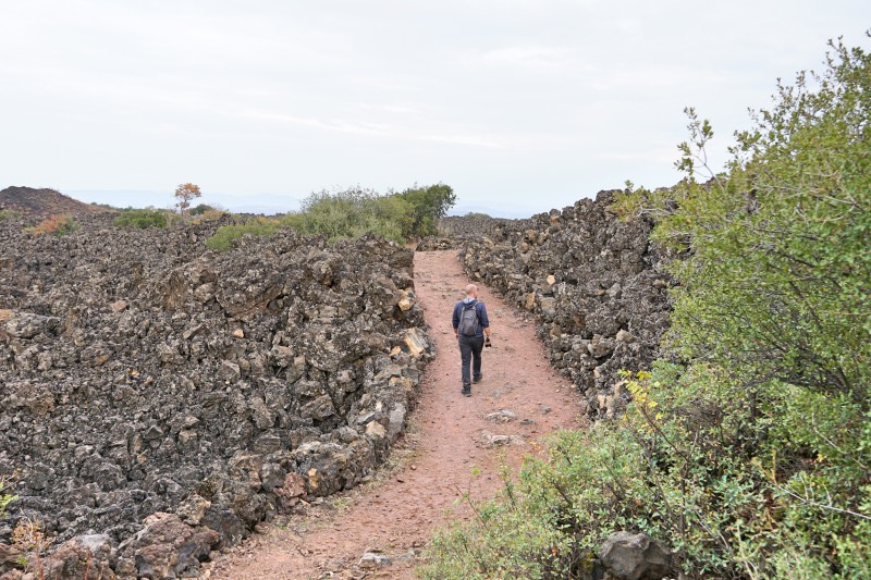
1,5 of the walking track. kilometers, there are wooden/suspension bridges. If you want to walk up to the bridges and return, you will walk 3 kilometers, if you want to walk the entire track, you will walk 6 kilometers round-trip. We came back from wooden bridges. There is another parking lot at the end of the 3-kilometer track. For walking or tour groups, it can be a good alternative to pick up the group from the end parking lot at the beginning parking lot. If you come individually, you need to go back to the parking lot you started, you can make your walking plan accordingly.
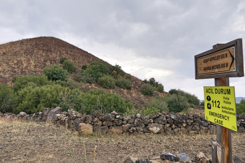
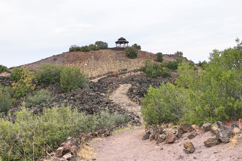
The entire walking path is beautifully laid out, the two sides of the path are marked with a low wall made of volcanic stones, the viewing points on the road and the signposts on the distance to the wooden bridges. The only missing thing I saw was that there were no maps of where to be on the path, other than that everything was extremely beautiful. Walking among extinct volcanoes and volcanic rocks got me so excited that I might not have wanted to miss it.
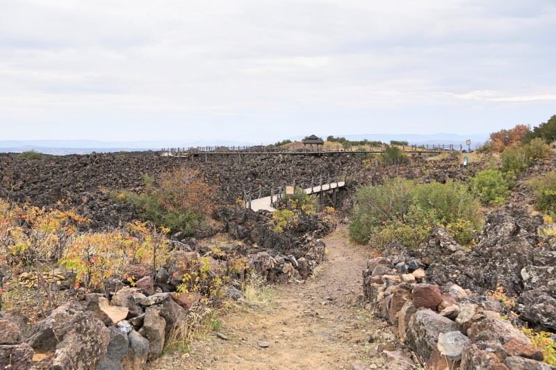
Since the entire hiking trail is dirt, it is better to wear comfortable sports shoes suitable for walking while coming here. It is a great pleasure to walk on the path among the black frozen lava ruins surrounding you.
There are about 90 erupted tiny volcano peaks in the park area. Only one of them has not exploded, and it is on the side of the walking path. Wooden Bridges When you see the sign that says 600 meters, the tiny hill on your left is the unexploded volcano.
On the hiking route, there are observation/monitoring points on the tiny hills. You can leave the trail and exit the lookout point, then return to the trail. You can even take your picnic supplies, sandwich or drink with you and enjoy the view. All but one have benches. Of course, provided that you do not leave your garbage there and take it back with you. If you go to at least one of the viewing points and watch the surroundings from above, you can more clearly understand the structure of the park and how interesting it is.
Kula Divlit Volcanic Park Wooden Bridges
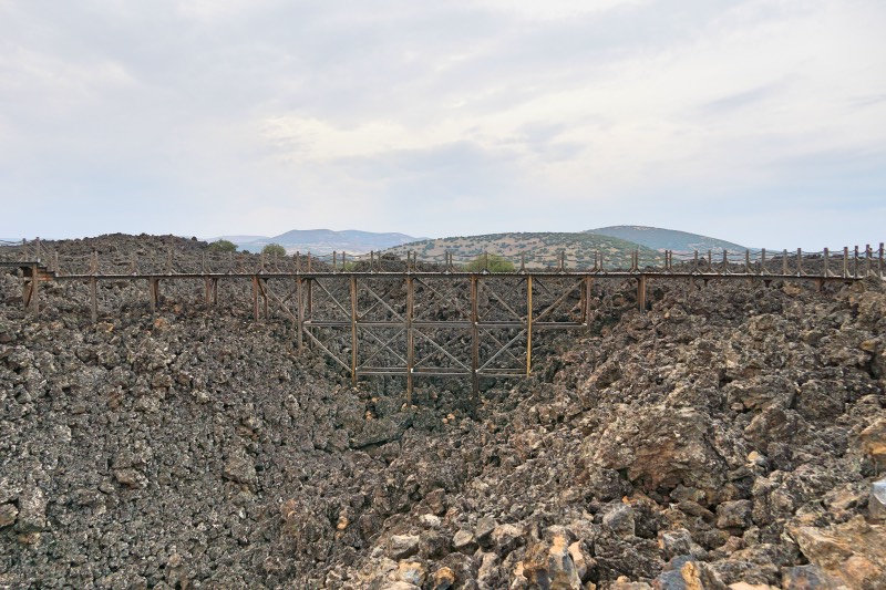
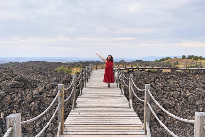
1,5 of the walking route. kilometers from each other, three wooden bridges rise above the extinct lava deposits. The bridges, where you can see the remnants of extinct lava from above, also look very aesthetically pleasing. The view of the bridges feels like you are walking through the lava of a newly erupted volcano.
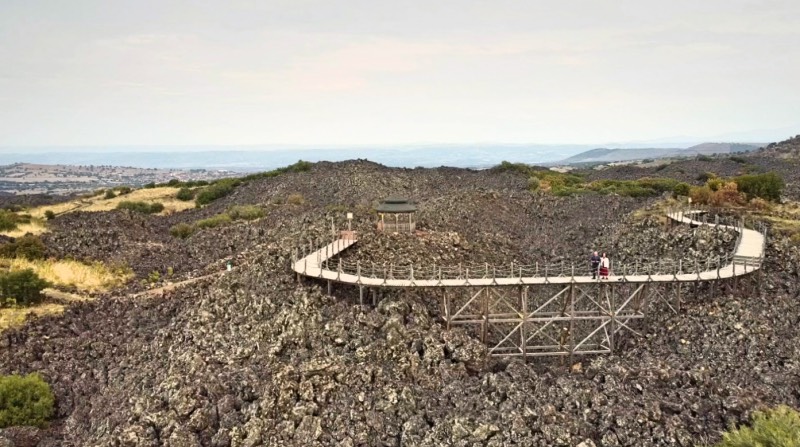
The wooden bridge at the end is the longest. It glides over the lava ruins, coiling like a snake. There is also a viewing point at the end of this bridge. If you wish, you can return to the parking lot from this viewing point or continue to finish the entire three-kilometer route. We preferred to return from the point where the wooden bridges are.
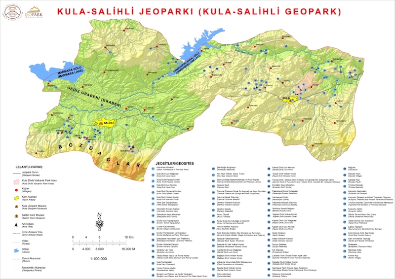
Kula – Salihli Geopark Map
Below is the Kula-Salihli Geopark map. You can understand the size of the area and the different points of the park from this map. Most of the touristic places in Manisa have information boards with this map.
What is Geopark?
Geopark is the name given to special nature protection areas that allow to see examples of geological heritage with similar or different characteristics together. These areas, which have international importance, enable us to have information about the formation of the earth and the earth's crust. Just like cultural heritage, geoparks are considered geological heritage for the world and are labeled by UNESCO.
There are 44 Geoparks from 161 countries within the UNESCO Global Geopark Network. The first and only geopark from Turkey to be included in this list is the Kula-Salihli Geopark in Manisa.
Places in Turkey on the UNESCO World Cultural Heritage List I suggest you take a look at my post.
Geopark Areas in Turkey
Although the Geological Heritage Preservation Society (JEMIRKO) proposes to declare many areas as geoparks in our country, the only geopark in Turkey is Salihli Kula Geopark.
Other Places to Visit in Manisa
If you have come to Kula Divlik Volcanic Park, I recommend you to visit other places to visit in Manisa, the list of which you will see below:
- Sardes Ancient City
- Sandal Divlit Volcano/Cone located within the Geopark Area
- Historical Kula Houses
- Kula Fairy Chimneys
- Çakırca Basalt Columns
- Tabduk Emre and Yunus Emre Tomb
- Adala Canyon
- Kurşunlu Thermal Springs
- Thermai Thessos Rock Carvings
- Suuçtu Waterfall
- Girl Bridge
Kula Divlit Volcanic Park Video
Kula Divlit Volcanic Park video is below. Do not hope to watch the video, like and subscribe to my channel!
Kula Divlit Volcanic Park Photos
All I have used in this article Kula Divlit Volcanic Park photos are below. Let me remind you that all photos are copyrighted by me. If you want to follow my photo diary, I'm waiting for you on my instagram account.

Kula Divlit Volcanic Park Kula Divlit Volcanic Park Kula Divlit Volcanic Park Kula Divlit Volcanic Park Kula Divlit Volcanic Park Kula Divlit Volcanic Park Kula Divlit Volcanic Park Kula Divlit Volcanic Park Kula Divlit Volcanic Park Walkway
